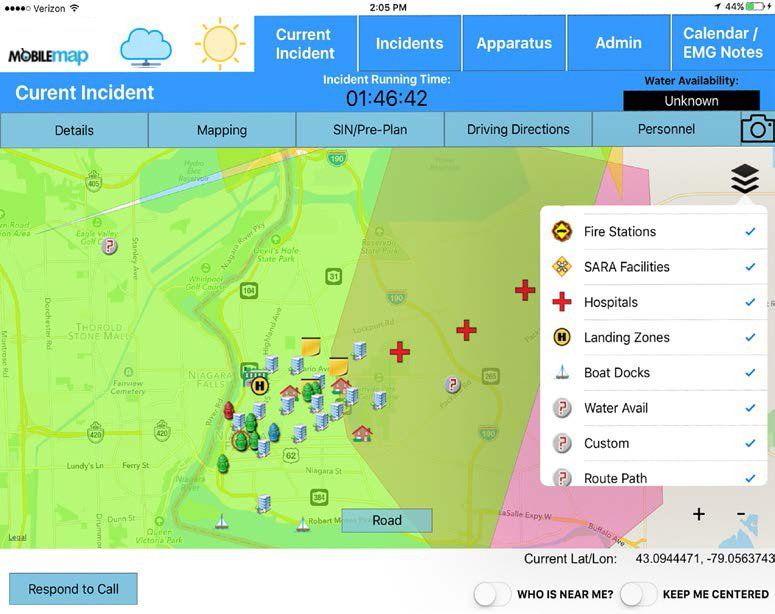
Mobile Map
Identify important locations in any emergency situation.
Convenient
Critical
Easy Install
What it does:
- Integrates with Geo Plan and similar GIS software
- Turn-by-turn directions
- Day and night mode
- View and track apparatuses responding and their personnel
- Photo capture of your incidents from the scene
- View other station’s data when giving mutual aid
- Create and edit district boundaries
- EMG Notes allow stations to identify road closures, outages, damaged water lines, etc.
- View and create events such as training exercises, fundraisers, department meetings, etc.
- Upload and view Pre-Plan information
provides accountability of responders
- Captures vehicle response data to transfer into NIFRS reporting software
- Provides automatic vehicle locator (AVL)